NASA's Landsat 9 satellite, designed to observe Earth's land surface, launched successfully on Monday, September 27, from California. It will partner with Landsat 8 to sustain this vital program's mission of monitoring, understanding, and managing our planet's resources.
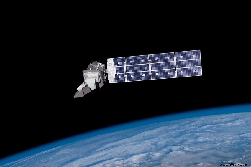
The Landsat program, an Earth observation initiative started in the mid-1960s by NASA in collaboration with the U.S. Geological Survey (USGS) and the Department of Agriculture, has launched nine satellites to date. The newest, Landsat 9, lifted off from Space Launch Complex 3E at Vandenberg Space Force Base aboard a United Launch Alliance Atlas V rocket. It's now ascending to its operational orbit at 705 kilometers altitude.
These satellites feature a wide 15-degree field of view and operate in sun-synchronous orbits. Equipped with advanced instruments, they capture millions of images in visible, panchromatic, and infrared spectra, supporting studies on climate change, land use, and more.
Landsat 9 now orbits alongside Landsat 8, enabling the pair to image the entire Earth every eight days.
"Landsat 9 will be our new eyes to observe our changing planet," said Thomas Zurbuchen, NASA's associate administrator for science. "Working alongside Landsat 8 and our partners at the European Space Agency with their Sentinel-2 satellites, we'll achieve unprecedented coverage—images from anywhere on Earth every other day."
As climate impacts intensify globally, Landsat 9 will inform evidence-based decisions on critical issues like water management, wildfire effects, coral reef decline, glacier retreat, and tropical deforestation. "Building on a 50-year data archive, Landsat 9 elevates this historic program to new heights," noted NASA Administrator Bill Nelson.
All Landsat imagery and data are freely available to the public, with NASA recording more than 100 million downloads since 2008.