NASA's Perseverance rover touched down on Mars on February 18, 2021, guided autonomously to the optimal landing site by unprecedentedly accurate maps during its descent.
NASA has successfully landed eight spacecraft on Mars to date, yet the feat remains challenging—roughly half of all attempts have failed.
A key challenge is that real-time manual control from Earth is impossible. With the spacecraft tens of millions of kilometers away, commands take over 12 minutes to arrive.
Previous missions relied on pre-programmed instructions for the high-risk descent. Perseverance follows suit but gains a critical edge with advanced technology.
Earlier successful landers used low-resolution maps covering broad elliptical zones.
The Mars 2020 mission introduces Terrain-Relative Navigation (TRN), enabling autonomous course corrections during descent.
These enhancements draw from maps crafted by the U.S. Geological Survey (USGS) using high-resolution imagery from NASA's Mars Reconnaissance Orbiter.
One map delivers 25 centimeters per pixel resolution to pinpoint hazards. The other provides a 6-meter-per-pixel view of surface features.
As it descends, a onboard camera captures the terrain. TRN compares these images to the maps and, if obstacles appear, fires retrorockets to redirect to safer ground.
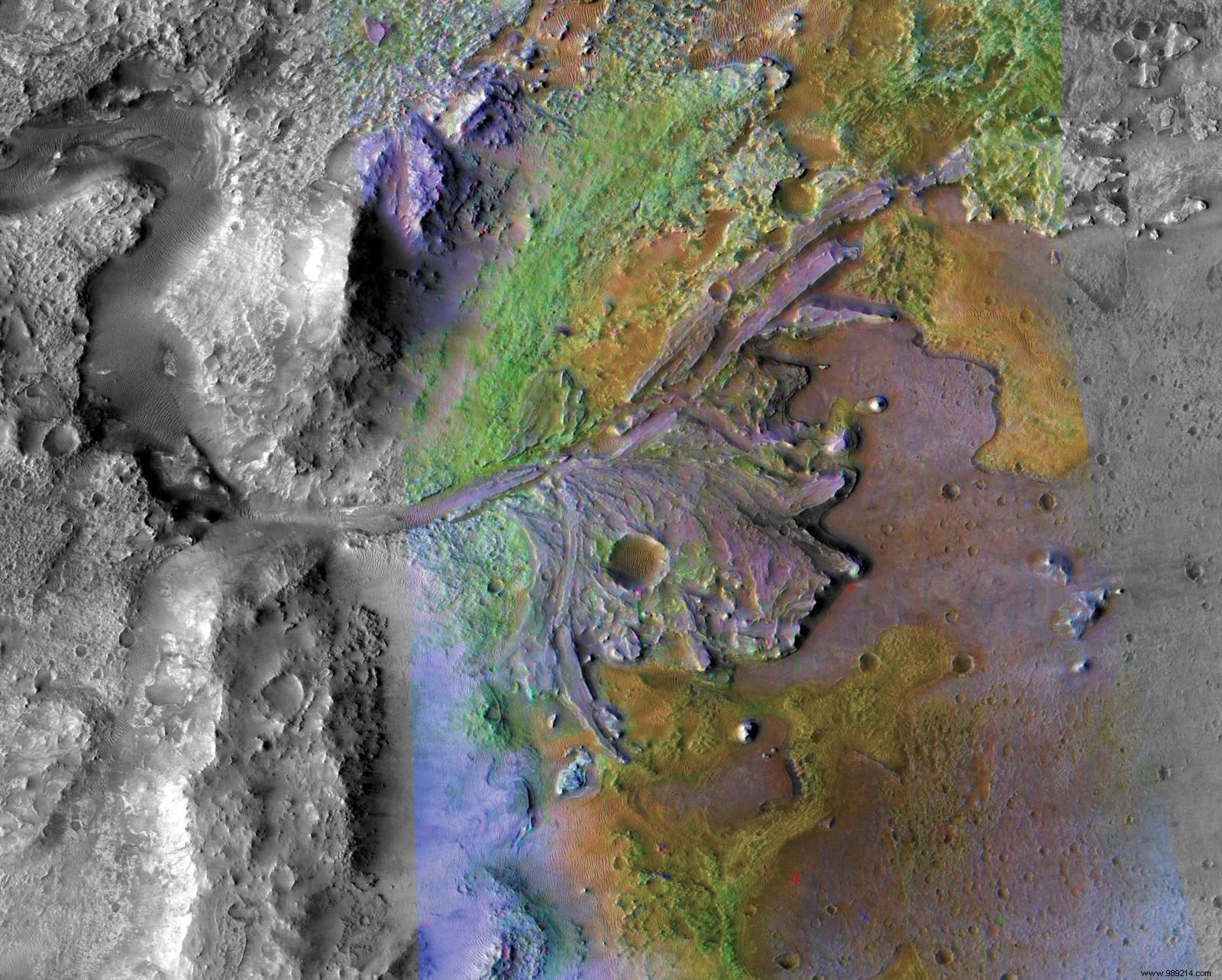
These innovations were vital for Jezero Crater (shown above)—a 45-kilometer-wide site once home to a lake and river delta, ideal for seeking signs of ancient life. Yet, the terrain, especially the delta, is rugged.
Mastering the landing unlocks Mars' geological secrets, advancing our quest to understand the Red Planet's history.